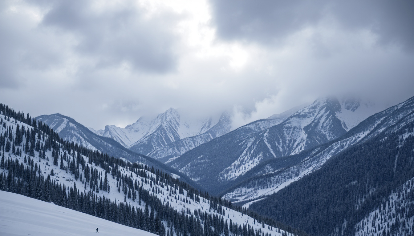
A late-season cold storm is barreling toward Colorado, Wyoming, Utah and Idaho, bringing with it the kind of heavy snow that can turn interstates into parking lots overnight. Officials have already issued Winter Storm Warnings for the region, and meteorologists are watching a second system lined up behind it.
Expected Snowfall: 12-24 inches · Affected States: Colorado, Wyoming, Utah, Idaho · Temperature Drop: 20-40 degrees · Peak Snow Depth: Up to 5 feet · Warnings Issued By: National Weather Service
Quick snapshot
- Warnings posted for CO, WY, UT, ID (NWS Grand Junction)
- Second storm arriving overnight through Sunday (NWS Grand Junction)
- Wind gusts forecast at 20-30 mph across the region (NWS Grand Junction)
- Exact timing of highway closures if conditions deteriorate
- Whether Idaho’s northern counties see heavier snow than currently forecast
- Duration of the second storm system beyond Sunday morning
- Second storm expected Saturday night through Sunday morning (NWS Grand Junction)
- Heavy snow band reducing visibility to quarter mile in Sweetwater County, WY (NWS Riverton)
- Monitor NWS alerts for real-time road condition updates
- Consider delaying non-essential travel through mountain passes
- Prepare vehicles with emergency supplies if travel is unavoidable
| Metric | Details |
|---|---|
| Storm Type | Late-season cold storm |
| Snow Range | 12-24 inches across highways |
| Peak Snow | 5 feet possible in high elevations |
| Temp Impact | 20-40 degree crash |
| Source | National Weather Service |
What is the Winter Storm Warning?
The National Weather Service has issued Winter Storm Warnings covering a broad swath of the central Rocky Mountains. This is a late-season cold storm pushing snow across Idaho, Montana, Wyoming, Utah, and Colorado, with temperatures expected to crash 20-40 degrees as the system moves through.
Issued States and Duration
The warnings stretch across four states: Colorado, Wyoming, Utah, and Idaho. A second storm system is expected to move through eastern Utah and western Colorado overnight through Sunday morning, bringing gusty winds of 20-30 mph, rain in the valleys, and accumulating snow in the mountains.
National Weather Service Details
The NWS Grand Junction office reports that a Winter Weather Advisory is currently in effect for the northern mountains of Colorado due to several inches of snow accumulation. Additionally, a Red Flag Warning for critical fire weather has been issued for southeast Utah and west-central Colorado due to windy, dry conditions ahead of the cold front. Drivers should note that current heavy snow in Wyoming is already impacting highways, with visibility reduced to a quarter mile in central Sweetwater County, according to NWS Riverton.
How Much Snow is Expected?
Forecasters are projecting 12-24 inches of snow across most highway corridors, with substantially higher totals in the mountains. A Winter Storm Warning has been issued for up to 5 feet of snow on western US highways, according to Autoblog’s coverage of the incoming system.
12-24 Inches on Highways
The headline number is 12-24 inches for most interstates and state highways in the affected area. However, meteorologists are emphasizing that terrain will create significant variations. Mountain passes and higher elevations will see substantially more than valley floors.
Up to 5 Feet in High Elevations
The January 2-6, 2023 winter storm provides a useful benchmark for what’s possible in this region. During that historic event, snowfall totals in Colorado’s high country reached 1-2 feet in the San Juan Mountains, 3+ feet in central and northern mountains, and locally up to 5 feet. The Tower SNOTEL station in the Park Range recorded an estimated 66 inches over the four-day period, per NWS Grand Junction data.
A station in Colorado’s Park Range measured 66 inches of snow during a comparable January 2023 storm. If current forecasts hold, some areas could approach that benchmark within days.
Which Highways Are Affected?
Travelers should anticipate significant disruptions across the major interstate corridors running through the region. The storm is slamming highways in Colorado, Wyoming, Utah, and Idaho, with winter driving conditions expected to develop rapidly.
Interstates in Colorado Wyoming Utah
The primary corridors at risk include I-70 through Colorado, which serves as the main east-west spine through the mountains, and I-80 in Wyoming. NWS Riverton reports that a heavy snow band has already developed over central Sweetwater County, Wyoming, reducing visibility to a quarter mile—a condition that makes interstate travel extremely hazardous. I-84 through Utah and I-15 in Idaho are also in the warning zone.
Road Conditions and Closures
While specific highway closure times remain uncertain, historical patterns from the January 2023 storm offer clues. During that event, an arctic front stalled along the I-70 corridor by the morning of January 5, causing heavy snow banding and significant travel disruptions. Plowable snowfall was reported in the Grand Valley and many lower-elevation locations after temperatures cooled behind the front, according to NWS Grand Junction’s storm summary. Travelers should check local NWS offices and state DOT websites for real-time updates.
NWS Riverton is already reporting quarter-mile visibility in Sweetwater County, Wyoming. That visibility reduction on I-80 could spread east or intensify as the storm builds—check conditions before committing to any mountain route.
What Temperature Changes Are Forecast?
The temperature drop accompanying this storm is dramatic. Forecasts indicate a 20-40 degree crash as the cold front moves through, transforming mild conditions into freezing or below-freezing temperatures within hours.
20-40 Degree Drops
The late-season cold storm is pulling arctic air south from Canada. As it moves through Idaho, Montana, Wyoming, Utah, and Colorado, temperatures are expected to fall 20-40 degrees. In some locations, this means dropping from above-freezing readings to single-digit or sub-zero wind chills overnight.
Freezing Conditions
The January 2023 storm offers a telling comparison: it “produced a plowable snowfall in the Grand Valley and many other lower-elevation locations after temperatures cooled behind the front,” noted NWS Grand Junction meteorologists. That storm dumped snow at elevations that typically see rain, confirming how quickly conditions can flip when arctic air arrives.
Local Forecasts for Western Colorado Eastern Utah
For those with specific destinations in mind, regional forecasts vary considerably based on terrain and proximity to the cold front’s leading edge.
NWS Clickable Map Resources
The National Weather Service provides local forecast tools at weather.gov. Visitors to the NWS Grand Junction page can access clickable maps showing current watches, warnings, and hourly forecasts tailored to specific locations in western Colorado and eastern Utah. The main hub at weather.gov/gjt serves as a regional clearinghouse for storm-related information across both states.
Latest Observations
Eastern Utah’s mountains—the Uintas and the La Sal/Abajo Ranges—received 5-15 inches during the January 2023 event. The Uncompahgre Plateau saw 35-45 inches, while the West Elk and Sawatch Ranges recorded 20-50 inches. Snow began in northern eastern Utah on January 3, spreading south through Wednesday and Thursday before ending north to south Thursday night. If the current storm follows a similar track, these ranges could see comparable or greater accumulations.
The second incoming storm is expected to deliver wind gusts of 20-30 mph alongside the snow. Those gusts will not only reduce visibility—they will push snow into already-cleared roads and create whiteout conditions in exposed areas.
Storm Timeline
Two weather patterns matter here: the immediate storm affecting Wyoming right now, and the historical benchmark from January 2023 that helps contextualize what’s possible in this region.
| Date | Event |
|---|---|
| January 2, 2023 | Snowfall begins northwest Colorado near Wyoming border |
| January 3, 2023 | Craig, CO receives over 1 foot of snow; arctic front retreats northward |
| January 4, 2023 | Significant snowfall resumes due to atmospheric river moisture |
| January 5, 2023 | Arctic front stalls along I-70 corridor; heavy snow banding develops |
| January 5-6, 2023 | Storm ends north to south; final snow measurements recorded |
| Current | Heavy snow band reduces visibility to quarter mile in Sweetwater County, WY |
The pattern from 2023 shows that these storms do not deliver snow uniformly—they pulse, with heavy bands setting up over specific corridors for hours at a time. The I-70 corridor near the arctic front’s leading edge saw the most intense banding during that event.
What We Know vs. What’s Still Uncertain
Confirmed
- Snow accumulation of 12-24 inches across most highway corridors
- Warnings posted for Colorado, Wyoming, Utah, and Idaho
- Temperatures dropping 20-40 degrees with storm passage
- Wind gusts of 20-30 mph accompanying precipitation
- Current visibility reduced to quarter mile in Sweetwater County, WY
- 5 feet of snow possible in highest elevations
Uncertain
- Exact timing and location of highway closures
- Whether Idaho’s northern counties see heavier snow than forecast
- Duration of second storm beyond Sunday morning
- Whether closures will affect major corridors like I-70 or I-80
What Experts Are Saying
This storm was notable for producing a plowable snowfall in the Grand Valley and many other lower-elevation locations after temperatures cooled behind the front.
— NWS Grand Junction meteorologists, NWS Grand Junction
Tower snotel in the Park Range the grand winner with an estimated 66 inches!
— NWS Grand Junction meteorologists, NWS Grand Junction
A heavy snow band developed over central Sweetwater County, reducing visibility to a quarter mile.
— NWS Riverton, NWS Riverton
Related reading: How to Clean Baseboard Heaters: Easy Step-by-Step Guide · First Day of Spring 2026 – Exact Time and Equinox Facts
NWS road updates highlight how the Wyoming temperature drop warning compounds freezing conditions, with sub-zero snaps disrupting highways from Colorado through Utah.
Frequently asked questions
Is Idaho also affected by this winter storm?
Yes. The late-season cold storm is pushing snow across Idaho alongside Montana, Wyoming, Utah, and Colorado. Interstate 15 through southern Idaho is within the warning zone, and temperatures are expected to drop 20-40 degrees across the region.
What should drivers do during the storm?
The National Weather Service recommends delaying non-essential travel if possible. If you must drive, carry emergency supplies including food, water, a flashlight, warm clothing, and a phone charger. Keep your gas tank at least half full and inform someone of your route and expected arrival time.
How to check real-time road conditions?
Check your state’s Department of Transportation website for live road condition updates. For Colorado, visit cotrip.org; for Wyoming, use wyoroad.com; for Utah, check udot.utah.gov; and for Idaho, visit 511.idaho.gov. The NWS also provides clickable local forecasts at weather.gov.
Will flights be impacted in Colorado?
Significant snowfall and freezing conditions at major airports like Denver International are likely. Airlines typically waive change fees during major winter storms. Check directly with your carrier for flight-specific updates and rebooking options.
What is the end time for the warnings?
The second storm is expected to run from Saturday night through Sunday morning, though exact end times vary by location. NWS offices typically update warnings every 6-12 hours, so check weather.gov for the latest specific timing for your area.
Are there power outage risks?
Heavy wet snow combined with wind gusts of 20-30 mph can bring down tree limbs and power lines. Residents in mountainous areas should prepare for possible outages by having flashlights, batteries, and backup heating options ready.
Historical snow records for these states?
The January 2-6, 2023 storm provides the most recent benchmark. During that event, the Tower SNOTEL station in Colorado’s Park Range recorded 66 inches, Gunnison received close to 2 feet, and the Uncompahgre Plateau saw 35-45 inches. A new storm warning is predicting up to 5 feet in high elevations.
How long will the winter storm last in Utah, Wyoming, and Colorado?
The immediate storm affecting Wyoming is ongoing. The second system moving through Colorado and Utah is forecast to last from Saturday night through Sunday morning. A longer-duration event, similar to the January 2023 storm that ran five days, could extend impacts if a follow-up system develops.
For travelers caught in this storm, the choice is straightforward: delay your trip if you can, or prepare thoroughly if you cannot. The combination of rapid temperature drops, heavy snow accumulations, and gusty winds creates conditions where even experienced mountain drivers can find themselves stranded. Check conditions before you leave, pack for the possibility of being stuck, and remember that plows need space to work—pulling over when you see them approaching is not just polite, it is safer for everyone on the road.